![Winter Storm Warning [THURSDAY UPDATE]](http://townsquare.media/site/483/files/2013/04/KSFY-Twitter-Pic-041813.png?w=980&q=75)
Winter Storm Warning [THURSDAY UPDATE]
The count is approaching "10" by the ref and we're still pinned under Mother Nature. Here is the latest on this Winter Storm Warning in effect until 1am Friday:
- Today: Snow. High near 33. Windy, with a north northwest wind 20 to 30 mph, with gusts as high as 40 mph. Chance of precipitation is 100%. Total daytime snow accumulation of around 4 inches.
- Tonight: Snow, mainly before 1am. Low around 22. Blustery, with a northwest wind 20 to 25 mph, with gusts as high as 35 mph. Chance of precipitation is 80%. New snow accumulation of around an inch possible.
- Friday: Mostly sunny, with a high near 37. Breezy, with a northwest wind 15 to 20 mph, with gusts as high as 30 mph.
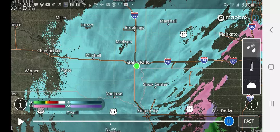
This snow or rain changing to snow will then likely spread across parts of northeast Nebraska, eastern South Dakota, southeast North Dakota, northwest Iowa, Minnesota, northern Wisconsin Thursday into early Friday.
Some of the heaviest snowfall totals (6 to 12 inches) may be found in a narrow zone from eastern South Dakota through central and northeast Minnesota.
The extended forecast shows what could be a wet start to early next week, too. Rain and snow mixes could occur Monday and Tuesday.
Very long term forecast, if it holds, will bring a little better news to the area. Could see temperatures nearing 70 by late next week.
More From KIKN-FM / Kickin' Country 99.1/100.5